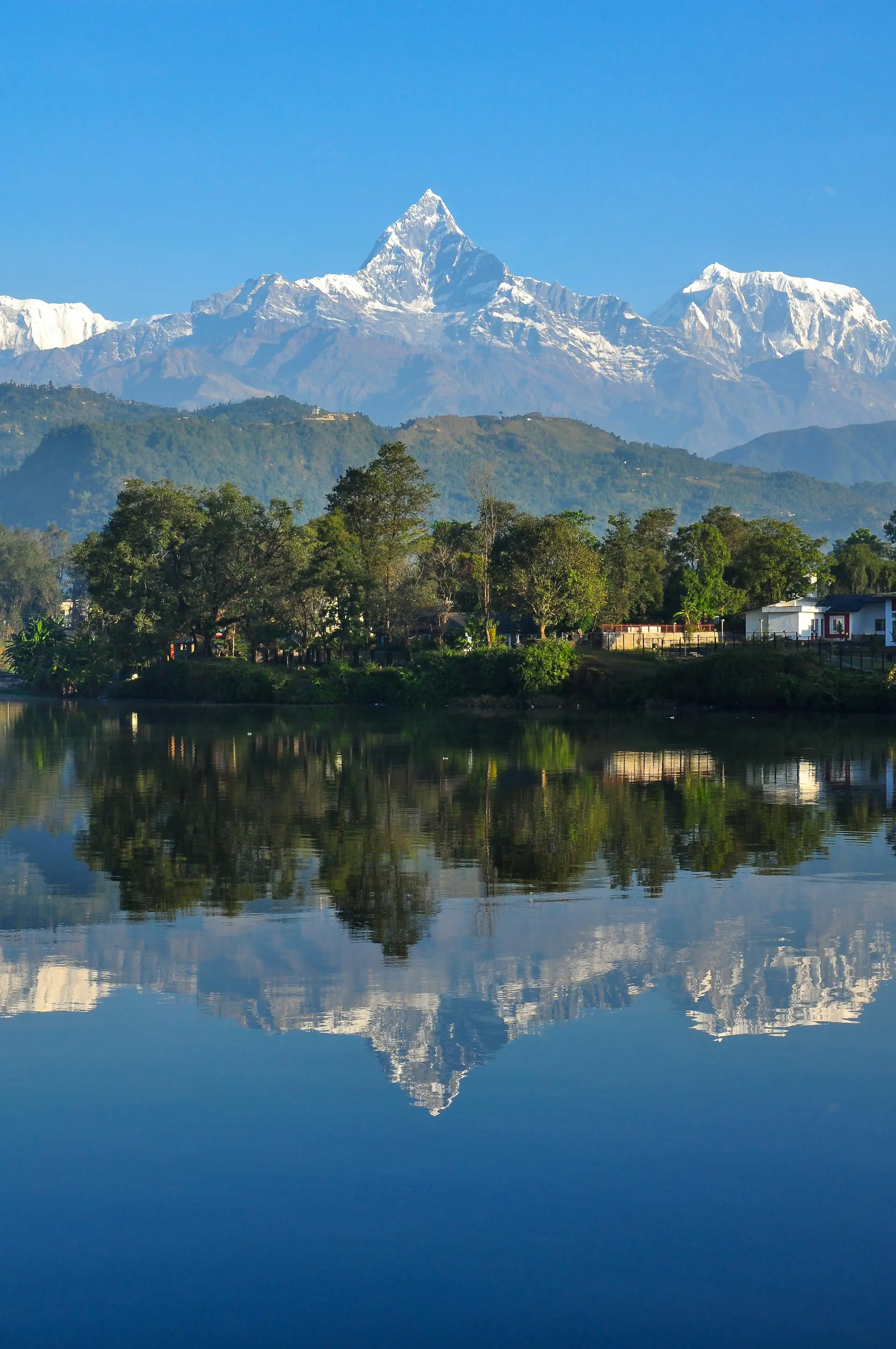

Overview
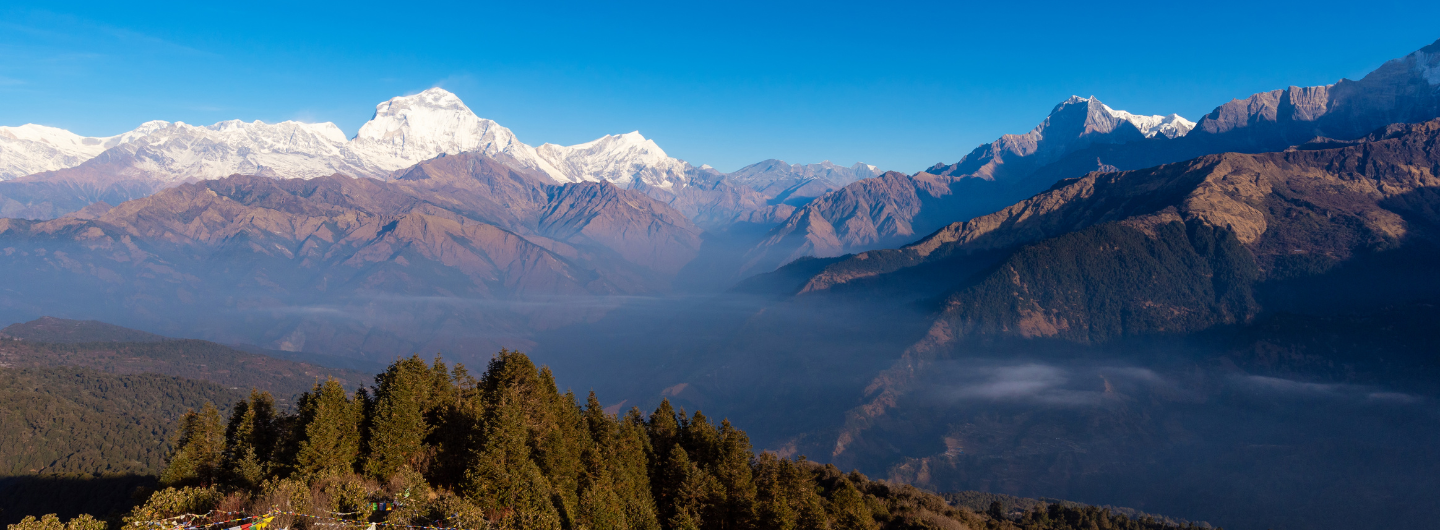
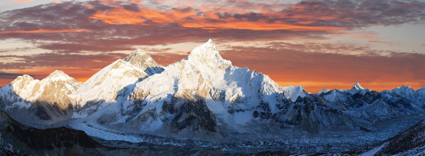
The Dhaulagiri Circuit Trek stands as one of Nepal’s most thrilling and challenging trekking adventures. This remote trek takes you around the world’s seventh-highest mountain, Mount Dhaulagiri (8,167 meters), through pristine wilderness, high mountain passes, and hidden valleys. Unlike the crowded trails of Everest or Annapurna, this off-the-beaten-path trek offers authentic Himalayan experiences with stunning landscapes and true wilderness camping. Whether you’re an experienced trekker seeking your next adventure or simply curious about this extreme trekking route, this comprehensive guide will help you understand everything about the Dhaulagiri Circuit Trek Nepal.
What is the Dhaulagiri Circuit Trek?
The Dhaulagiri Circuit Trek is a spectacular camping trek in Nepal that circles the magnificent Dhaulagiri massif. Consequently, this journey takes adventurers through diverse terrain, including lush forests, glacial valleys, and barren high-altitude landscapes. Moreover, the trek crosses two challenging high passes, French Pass (5,360 meters) and Dhampus Pass (5,200 meters), making it one of the most demanding yet rewarding extreme trekking routes in Nepal.
Key Highlights Include:
- Circumnavigation of Mount Dhaulagiri
- Crossing two high mountain passes
- Exploring the mysterious Hidden Valley
- Camping in pristine wilderness areas
- Encountering minimal tourist traffic
Therefore, this trek appeals to seasoned trekkers who seek solitude and adventure. Furthermore, the route provides unparalleled views of Dhaulagiri I, II, III, and other surrounding peaks. Additionally, trekkers experience authentic Himalayan culture in remote villages along the way.
Why Choose the Dhaulagiri Circuit Trekking Route?
The Dhaulagiri Circuit trekking route offers experiences that distinguish it from other challenging treks in Nepal. First and foremost, the trail passes through virtually untouched wilderness areas where nature remains pristine and pure. Subsequently, trekkers enjoy solitude rarely found on more popular routes like Everest Base Camp or Annapurna Circuit.
Unique Features:
- Authentic wilderness camping experience
- Dramatic landscape diversity
- Glacial crossings and ice fields
- Rich biodiversity in the lower regions
- Spectacular mountain panoramas
Moreover, this off-the-beaten-path trek in Nepal provides cultural encounters with local communities who maintain traditional lifestyles. Additionally, the sense of accomplishment after completing this demanding route creates unforgettable memories. Therefore, adventurers who crave genuine Himalayan exploration find this trek particularly appealing.
Dhaulagiri Circuit Trek Difficulty Level
Understanding the Dhaulagiri Circuit trekking difficulty level helps trekkers prepare appropriately for this challenging adventure. Indeed, this trek ranks among the most demanding in Nepal due to multiple factors. Primarily, the high altitude, technical terrain, and remote location create significant challenges even for experienced mountaineers.
Difficulty Factors:
- Extremely high altitude with limited acclimatisation opportunities
- Technical glacier crossings require equipment
- Long daily trekking hours (6-8 hours average)
- Unpredictable weather conditions
- Limited rescue and medical facilities
Furthermore, trekkers must be physically fit with previous high-altitude trekking experience. Consequently, proper training and preparation become essential before attempting this route. Additionally, mental resilience plays a crucial role since the trek demands perseverance through challenging conditions. Therefore, only well-prepared adventurers should consider this extreme trekking route.
| Difficulty Aspect | Rating (1-5) | Description |
|---|---|---|
| Physical Demand | 5/5 | Extremely strenuous with long days |
| Technical Skills | 4/5 | Glacier crossing, rope work needed |
| Altitude Challenge | 5/5 | Multiple high passes above 5,000m |
| Trail Conditions | 4/5 | Rough, unmarked in sections |
| Overall Difficulty | 5/5 | Expert-level trek only |
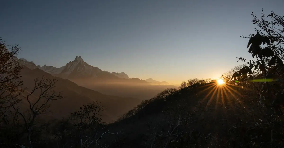
Best Time for Dhaulagiri Circuit Trek
Determining the best time for the Dhaulagiri Circuit Trek significantly impacts your experience and safety. Generally, two primary seasons offer optimal conditions for this challenging trek. Specifically, spring (March to May) and autumn (September to November) provide the most stable weather and clearer mountain views.
Spring Season (March-May):
- Warmer temperatures at high altitude
- Rhododendron forests in bloom
- Increasing daylight hours
- Moderate crowds (still very few)
Autumn Season (September-November):
- Crystal-clear mountain views
- Stable weather patterns
- Comfortable temperatures
- Post-monsoon fresh landscapes
Conversely, winter (December-February) brings extreme cold and heavy snowfall, making high passes nearly impossible. Similarly, monsoon season (June-August) creates dangerous conditions with landslides, leeches, and obscured views. Therefore, planning your Dhaulagiri Circuit trek during the recommended seasons ensures better safety and enjoyment.
Dhaulagiri Circuit Trekking Route: Day-by-Day Breakdown
The Dhaulagiri Circuit trekking route follows a clockwise direction around the mountain massif. Initially, trekkers travel from Kathmandu to Beni, then to Dharapani, where the actual trek begins. Subsequently, the trail gradually ascends through terraced farmlands, forests, and eventually reaches alpine zones.
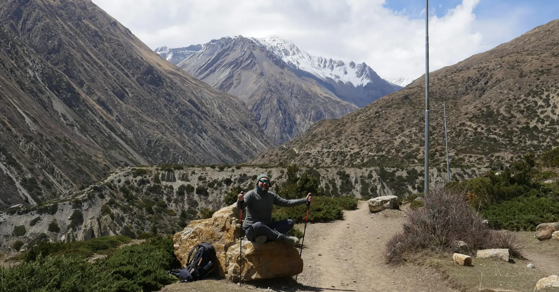
Lower Section: Dharapani to Italian Base Camp
The journey begins with moderate hiking through traditional villages and agricultural terraces. Consequently, trekkers experience local culture while their bodies adjust to increasing altitude. Moreover, the trail passes through Muri, Naura Khola, and Chartare before reaching Italian Base Camp.
Key Stops:
- Dharapani (1,560m) – Trek starting point
- Muri (1,850m) – Traditional Magar village
- Naura Khola (2,350m) – Riverside camping
- Boghara (2,080m) – Forest camping site
- Italian Base Camp (3,660m) – Major acclimatisation stop
Furthermore, this section provides excellent preparation for higher altitudes ahead. Additionally, trekkers encounter diverse vegetation from subtropical to alpine zones. Therefore, taking time to acclimatise properly in this section reduces altitude sickness risks later.
Middle Section: Crossing French Pass and Hidden Valley
After the Italian Base Camp, the trek becomes significantly more challenging. Specifically, trekkers navigate glacial moraines and snowfields toward French Pass Dhaulagiri. Subsequently, crossing this 5,360-meter pass requires good weather, proper equipment, and strong determination.
Major Highlights:
- Glacier Camp (4,210m) – Base for French Pass attempt
- French Pass (5,360m) – First major high pass
- Hidden Valley Dhaulagiri (5,200m) – Breathtaking basin
- Dhaulagiri Base Camp (4,740m) – Close-up mountain views
Moreover, Hidden Valley offers surreal landscapes with towering peaks surrounding you completely. Additionally, this remote camping area provides unmatched photographic opportunities. Therefore, many trekkers consider this section the most rewarding despite its difficulty.
Upper Section: Dhampus Pass Trek and Descent
The final major challenge involves crossing the Dhampus Pass trek, which stands at 5,200 meters. Interestingly, despite being slightly lower than French Pass, this crossing often proves equally challenging. Subsequently, after successfully crossing, trekkers descend rapidly toward Yak Kharka and eventually Jomsom.
Descent Route:
- Dhampus Pass (5,200m) – Second major pass
- Yak Kharka (3,680m) – Alpine pasture camping
- Marpha (2,670m) – Apple orchard village
- Jomsom (2,720m) – Trek endpoint with airport
Consequently, the descent brings relief and warmer temperatures quickly. Furthermore, villages like Marpha offer comfortable lodges and famous apple products. Therefore, trekkers can celebrate their achievement while enjoying better facilities.
French Pass Dhaulagiri and Dhampus Pass Trek
Understanding the French Pass Dhaulagiri and Dhampus Pass trek crossing requirements ensures proper preparation. Both passes represent significant technical and physical challenges requiring specific equipment and skills. Moreover, weather conditions can change rapidly, making timing crucial for safe crossings.
French Pass Technical Requirements
French Pass demands the most technical skills on the entire Dhaulagiri Circuit high pass trek. Specifically, trekkers encounter steep ice sections, crevasse zones, and loose rock areas. Therefore, using crampons, ice axes, and safety ropes becomes necessary.
Essential Equipment:
- Crampons for glacier travel
- An ice axe for stability
- Climbing harness and rope
- Helmet for rockfall protection
- High-altitude boots
Furthermore, early morning starts (2-3 AM) help ensure firmer snow conditions. Additionally, guides typically fix ropes on steeper sections for added safety. Consequently, following your guide’s instructions precisely becomes critically important here.
Dhampus Pass Crossing Strategy
While the Dhampus Pass trek involves less technical climbing, altitude and exposure create challenges. Indeed, the pass offers spectacular views but demands respect due to unpredictable weather. Moreover, proper acclimatisation before attempting this crossing prevents serious altitude issues.
Crossing Tips:
- Start early to avoid afternoon weather
- Maintain a steady breathing rhythm
- Stay hydrated throughout the ascent
- Watch for altitude sickness symptoms
- Follow established trail markers
Additionally, the descent from Dhampus Pass requires careful foot placement on loose scree. Therefore, using trekking poles provides valuable stability and reduces knee strain significantly.
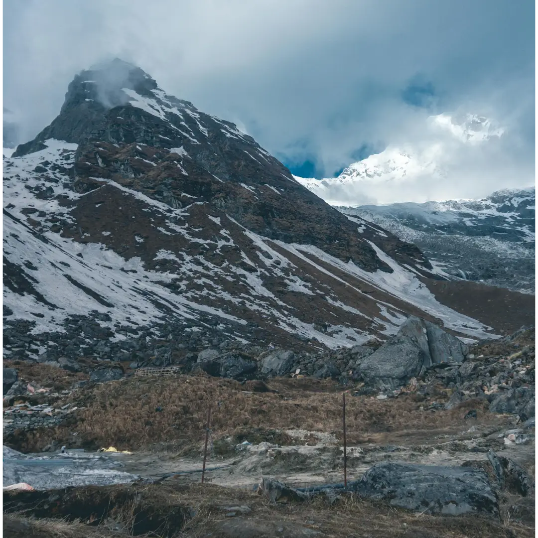
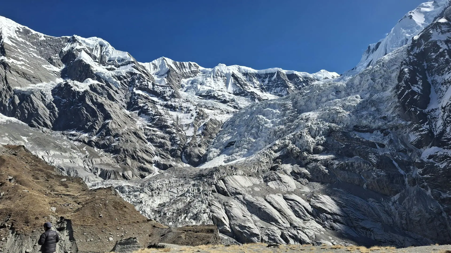
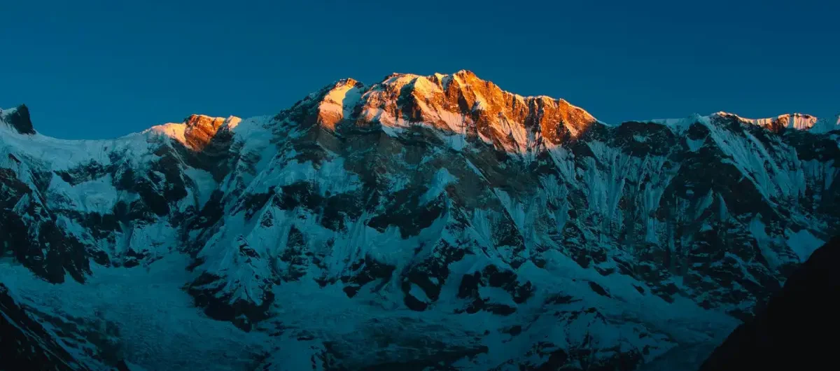
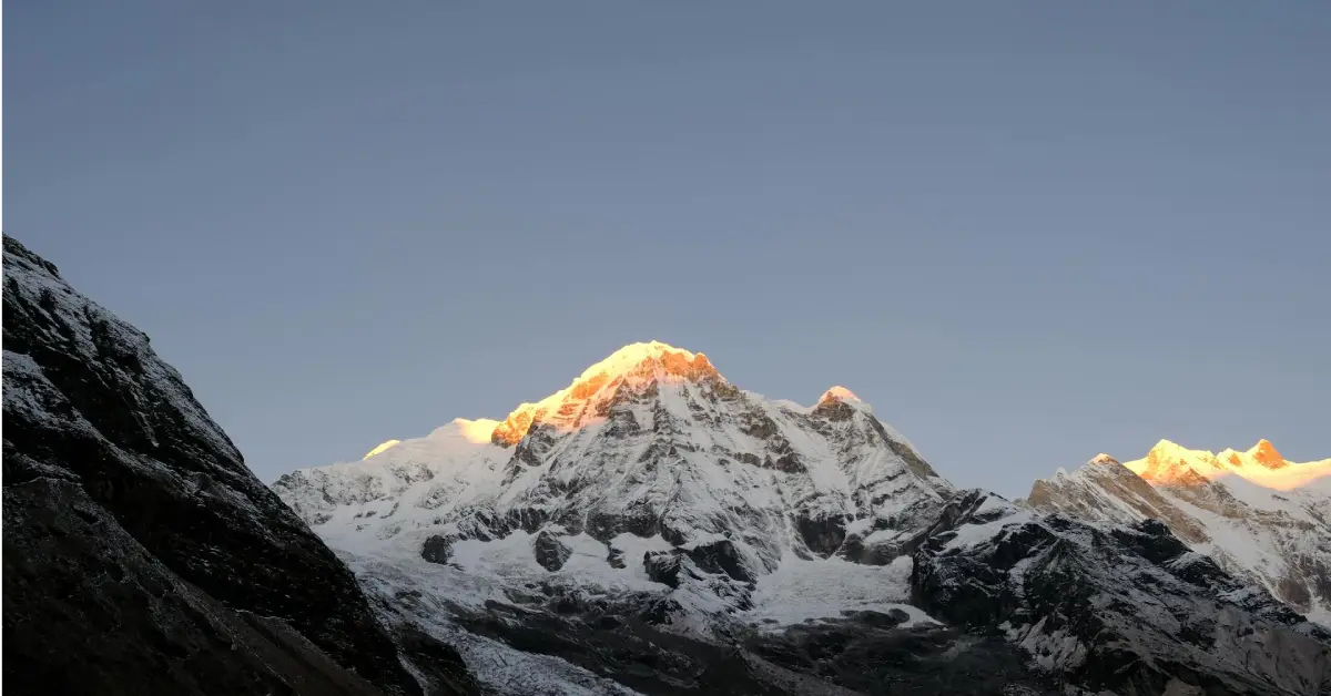
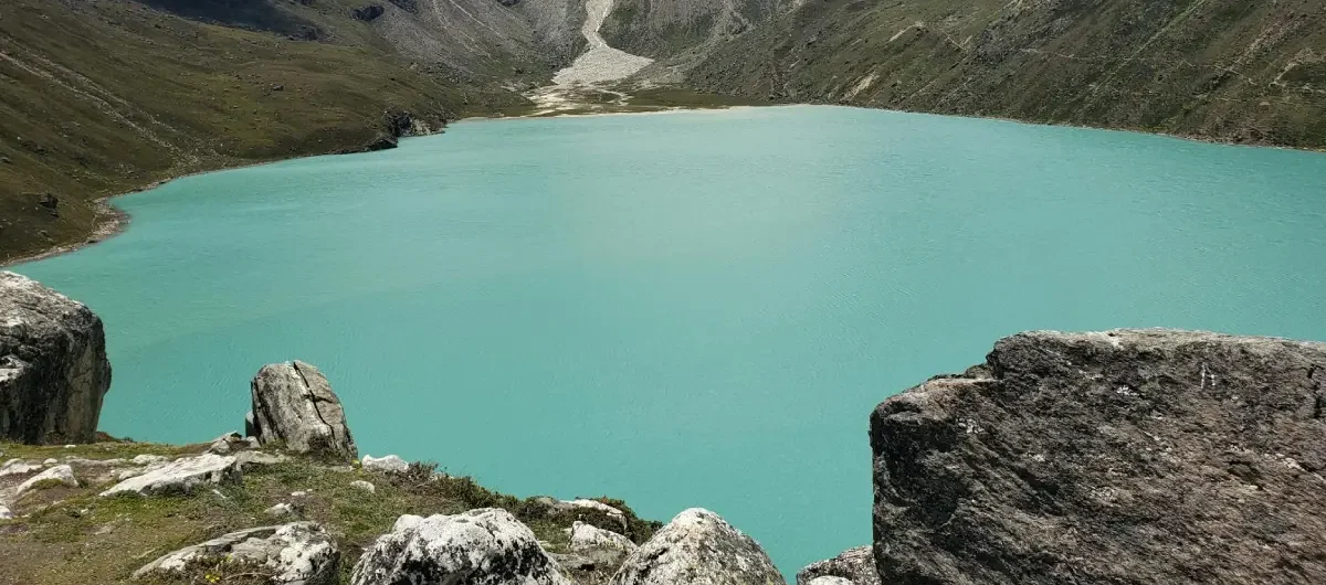
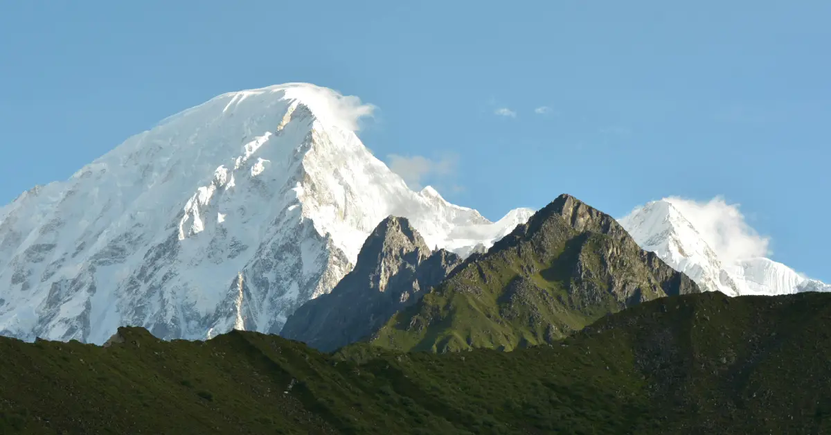
Hidden Valley Dhaulagiri: Nature’s Secret Paradise
Hidden Valley Dhaulagiri stands as one of the trek’s most spectacular highlights and geographical wonders. Essentially, this high-altitude basin sits nestled between towering Himalayan giants, creating otherworldly scenery. Moreover, the valley remains snowbound most of the year, preserving its pristine beauty.
The valley earned its name due to being surrounded by peaks, making it invisible from the outside. Consequently, early explorers stumbled upon it unexpectedly, hence “hidden.” Furthermore, the stark landscape features glacial formations, frozen lakes, and dramatic ice walls.
Valley Features:
- Elevation approximately 5,200 meters
- Surrounded by seven-thousand-foot peaks
- Glacial lakes and ice formations
- Minimal vegetation due to altitude
- Excellent acclimatisation location
Therefore, spending a rest day in Hidden Valley helps bodies adjust while providing incredible photographic opportunities. Additionally, the serene isolation offers spiritual experiences for many trekkers. Consequently, this remote camping spot becomes memorable for virtually everyone who visits.
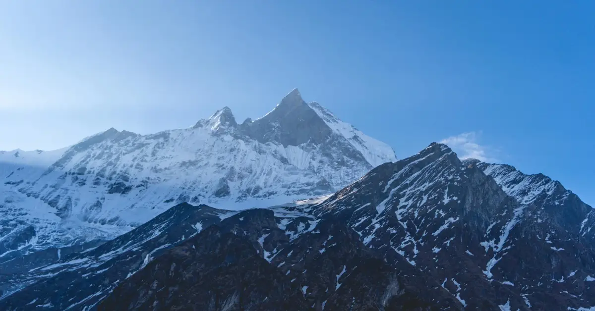
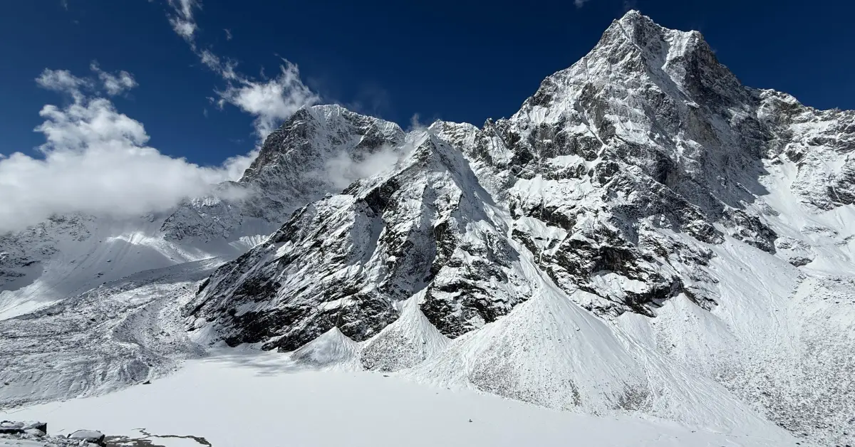
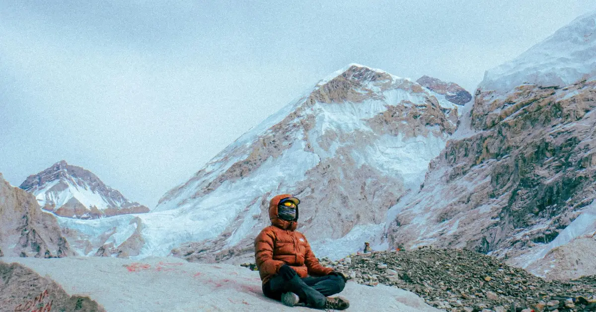
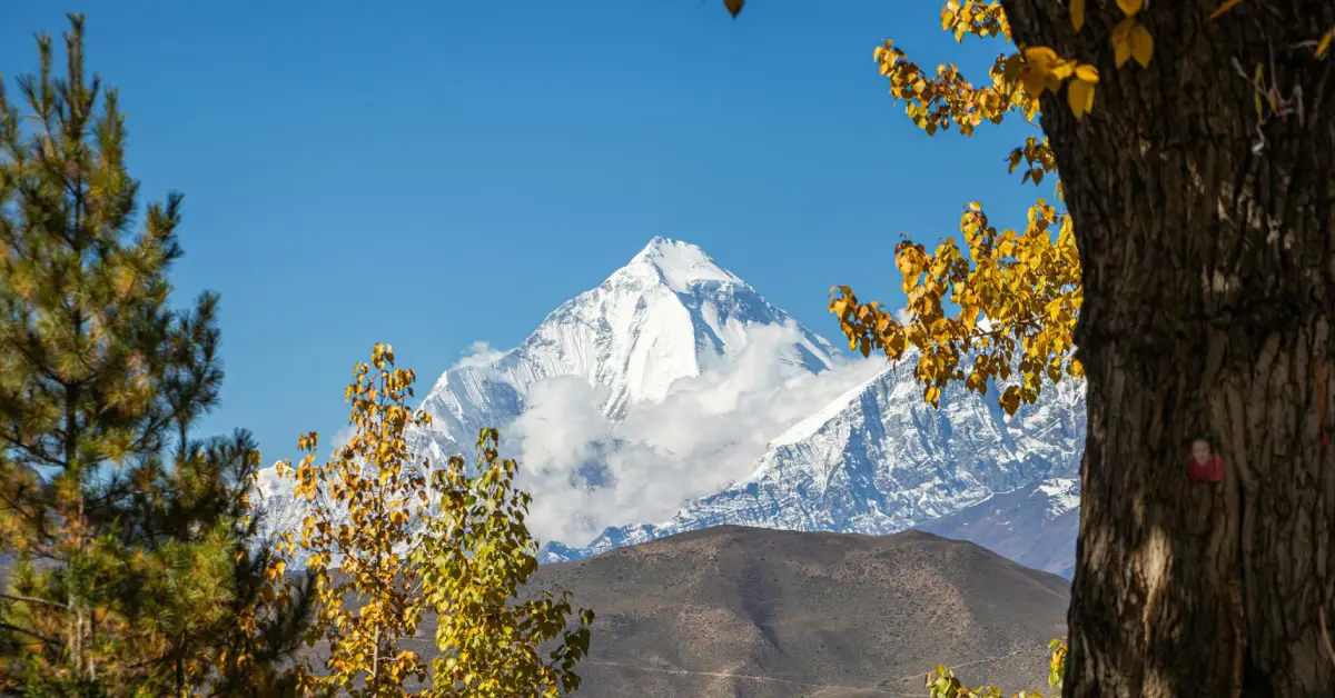
Dhaulagiri Base Camp Trek Experience
The Dhaulagiri Base Camp trek section provides the closest approach to the mountain’s massive south face. Specifically, Base Camp sits at 4,740 meters, offering breathtaking views of hanging glaciers and ice formations. Moreover, this location serves as the staging area for mountaineering expeditions attempting the summit.
From Base Camp, Dhaulagiri’s sheer scale becomes overwhelmingly apparent. Indeed, the mountain towers nearly 3,500 meters directly above, creating an intimidating yet beautiful spectacle. Furthermore, trekkers often encounter climbing expeditions preparing for summit attempts during peak seasons.
Base Camp Highlights:
- Proximity to Dhaulagiri’s south face
- Prayer flags and climbing memorials
- Glacial ice formations
- Possible wildlife sightings (Himalayan tahr, blue sheep)
- Expedition camp facilities occasionally present
Additionally, sunrise views from Base Camp rank among the trek’s most memorable moments. Therefore, waking early despite the cold provides rewards worth the discomfort. Consequently, many trekkers consider reaching Base Camp their primary achievement.
| Location | Elevation | Distance from Italian BC | Key Features |
|---|---|---|---|
| Italian Base Camp | 3,660m | Starting point | Acclimatization hub |
| Glacier Camp | 4,210m | 7-8 km | Pre-French Pass camp |
| Dhaulagiri Base Camp | 4,740m | 12-14 km | Mountain proximity |
| Hidden Valley | 5,200m | 16-18 km | Surrounded basin |
Dhaulagiri Circuit Trek Altitude: Understanding Elevation Challenges
The Dhaulagiri circuit trek altitude profile presents significant challenges requiring careful management. Specifically, trekkers gain over 3,600 meters in elevation from start to highest point. Moreover, multiple nights above 4,000 meters increase altitude sickness risks considerably.
Dhaulagiri Circuit Trek Altitude Profile
Understanding elevation gains helps trekkers prepare mentally and physically for challenges ahead. Initially, the trek starts around 1,560 meters at Dharapani. Subsequently, altitude increases gradually through the lower sections before steep gains near high passes.
Altitude Milestones:
- Dharapani: 1,560 meters (starting point)
- Italian Base Camp: 3,660 meters
- Glacier Camp: 4,210 meters
- Dhaulagiri Base Camp: 4,740 meters
- Hidden Valley: 5,200 meters
- French Pass: 5,360 meters (highest point)
- Dhampus Pass: 5,200 meters
Furthermore, the rapid descent after Dhampus Pass brings relief from altitude stress. Therefore, completing both high passes within days requires excellent acclimatisation. Consequently, proper preparation and gradual ascent become essential for success.
Acclimatization Strategy
Preventing altitude sickness requires following proven acclimatisation principles throughout the Dhaulagiri Circuit high pass trek. Primarily, “climb high, sleep low” whenever possible helps bodies adjust gradually. Additionally, maintaining proper hydration and nutrition supports acclimatisation processes.
Acclimatisation Tips:
- Add rest days at Italian Base Camp
- Short acclimatisation hikes daily
- Drink 4-5 litres of water daily
- Avoid alcohol and sleeping pills
- Monitor symptoms constantly
Moreover, recognising early altitude sickness symptoms allows timely descent if necessary. Therefore, trekkers must be honest about their condition with guides and team members. Consequently, evacuation from serious altitude sickness can be complex and expensive in this remote area.
Dhaulagiri Circuit Trek Distance: Total Kilometres Covered
The Dhaulagiri circuit trek distance varies slightly depending on exact route variations and side trips. Generally, trekkers cover approximately 130-150 kilometres throughout the complete circuit. Moreover, the technical difficulty makes the distance feel considerably longer than easier, lower-altitude treks.
Distance Breakdown by Section
Understanding daily distances helps trekkers gauge their pace and energy requirements effectively. Specifically, daily distances range from 8 to 15 kilometres depending on terrain difficulty and altitude. Furthermore, shorter distances at high altitude prevent overexertion and altitude sickness.
Section Distances:
- Dharapani to Italian Base Camp: approximately 45 km
- Italian Base Camp to Hidden Valley: approximately 25 km
- Hidden Valley to Dhampus Pass crossing: approximately 15 km
- Dhampus Pass to Jomsom: approximately 50 km
Additionally, these distances exclude side trips to viewpoints or acclimatisation hikes. Therefore, total walking distance often exceeds the direct circuit measurement. Consequently, preparing for extended daily walking hours becomes necessary.
| Trek Day | Section | Approx. Distance | Elevation Gain/Loss |
|---|---|---|---|
| Day 1-3 | Dharapani to Muri | 25 km | +500m |
| Day 4-6 | Muri to Italian BC | 20 km | +1,800m |
| Day 7-9 | Italian BC to Base Camp | 15 km | +1,080m |
| Day 10-12 | High Passes Section | 18 km | +650m/-2,500m |
| Day 13-16 | Descent to Jomsom | 50 km | -2,500m |
Dhaulagiri Circuit Trek Permit: Required Documentation
Understanding Dhaulagiri circuit trek permit requirements prevents delays and ensures legal compliance. Specifically, several permits and documents become necessary before starting this remote trek. Moreover, permit regulations can change, so verifying current requirements before departure proves essential.
Required Permits
The Dhaulagiri Circuit Trek Nepal requires multiple permits due to its location in restricted and conservation areas. Primarily, trekkers need permits from both conservation authorities and local government bodies. Additionally, foreign trekkers must trek with registered guides in restricted areas.
Essential Permits:
- Dhaulagiri Rural Municipality Permit
- Annapurna Conservation Area Permit (ACAP)
- TIMS Card (Trekkers’ Information Management System)
- Restricted Area Permit (certain sections)
Furthermore, permits must be arranged through registered trekking agencies; individual trekkers cannot obtain them independently. Therefore, booking with reputable agencies ensures proper documentation. Consequently, carrying photocopies of all permits provides backup if originals are lost.
Permit Acquisition Process
Obtaining permits requires advance planning and proper documentation submission. Specifically, agencies handle permit applications, but trekkers must provide necessary documents and photographs. Moreover, permit processing typically takes 3-5 working days in Kathmandu.
Required Documents:
- Valid passport (minimum 6 months validity)
- Passport-size photographs (4-6 copies)
- Travel insurance details
- Trekking itinerary
- Agency registration details
Additionally, some permits have specific validity periods requiring careful timing. Therefore, coordinating permit acquisition with your departure date prevents wastage or delays. Consequently, working with experienced agencies simplifies this sometimes-complicated process.
Altitude Sickness in Dhaulagiri Circuit: Prevention and Management
Understanding altitude sickness in the Dhaulagiri Circuit helps trekkers recognise and respond to symptoms appropriately. Indeed, acute mountain sickness (AMS) affects many trekkers due to rapid elevation gains and high altitudes. Moreover, more serious conditions like HACE and HAPE can develop if symptoms are ignored.
Recognising Altitude Sickness Symptoms
Early symptom recognition allows timely intervention, preventing serious complications. Primarily, mild AMS symptoms include headaches, nausea, dizziness, and fatigue. However, these symptoms can rapidly progress if trekkers continue ascending without proper acclimatisation.
Mild AMS Symptoms:
- Persistent headache
- Nausea or vomiting
- Dizziness and lightheadedness
- Fatigue and weakness
- Difficulty sleeping
Severe Symptoms (HACE/HAPE):
- Severe shortness of breath at rest
- Confusion or irrational behavior
- Loss of coordination (ataxia)
- Persistent coughing with frothy sputum
- Chest tightness or congestion
Furthermore, never ignore altitude sickness symptoms, hoping they will improve spontaneously. Therefore, immediate descent becomes necessary if severe symptoms develop. Consequently, evacuation arrangements should be understood before starting the trek.
Prevention and Treatment Strategies
Preventing altitude sickness in the Dhaulagiri Circuit requires following established guidelines and listening to your body. Primarily, gradual ascent with proper rest days allows natural acclimatisation. Additionally, staying hydrated and maintaining good nutrition supports physiological adaptation.
Prevention Methods:
- Ascend gradually (maximum 500m per day above 3,000m)
- Include rest days every 3-4 days
- Stay hydrated (4-5 litres daily)
- Avoid alcohol and sedatives
- Consider altitude sickness medication (consult doctor)
Moreover, carrying altitude sickness medication like Diamox provides additional safety margins. However, medication supplements do not replace proper acclimatisation. Therefore, consulting travel medicine specialists before departure ensures appropriate pharmaceutical preparation.
Dhaulagiri Circuit Trek Packing List
Creating a comprehensive Dhaulagiri Circuit trekking packing list ensures you carry essential items without excessive weight. Specifically, this camping trek requires more gear than lodge-based treks since facilities are minimal. Moreover, extreme temperatures and technical terrain demand specialised equipment.
Clothing Requirements
Proper clothing layering proves essential for managing variable temperatures and conditions. Specifically, temperatures range from hot afternoons in the lower sections to extreme cold at high passes. Therefore, versatile, high-quality clothing becomes necessary rather than optional.
Essential Clothing:
- Base layers (merino wool or synthetic)
- Insulating mid-layers (fleece or down)
- Waterproof and windproof outer shell jacket
- Insulated down jacket for high altitude
- Trekking pants (quick-dry, convertible)
- Waterproof pants
- Warm hat and sun hat
- Gloves (liner gloves plus insulated mittens)
- Warm socks (wool or synthetic, multiple pairs)
Furthermore, bringing extra warm layers for high camps prevents dangerous situations. Additionally, hand and foot warmers provide comfort during early morning starts. Therefore, prioritising warmth over weight saves potential suffering at altitude.
Technical Equipment
The Dhaulagiri Circuit high pass trek demands specific technical equipment for safe passage. Primarily, glacier crossing requires crampons, ice axes, and harnesses. Moreover, high-quality camping gear withstands harsh conditions better than budget alternatives.
Technical Gear:
- Crampons (compatible with your boots)
- Ice axe
- Climbing harness
- Helmet
- High-altitude mountaineering boots
- Trekking poles (adjustable)
- Headlamp with extra batteries
- Sunglasses (category 4, glacier glasses)
- Sleeping bag (-15°C to -20°C rating)
Additionally, many trekking agencies provide technical equipment rentals in Kathmandu. However, testing rented gear before departure ensures proper fit and function. Consequently, arriving in Nepal several days early allows adequate preparation time.
Personal and Safety Items
Beyond clothing and technical gear, numerous personal items enhance comfort and ensure safety. Specifically, first aid supplies, navigation tools, and emergency equipment prove invaluable in remote areas. Moreover, backup systems for critical items provide security if the primaries fail.
Safety Essentials:
- Comprehensive first aid kit
- Altitude sickness medication
- Water purification system
- A GPS device or a smartphone with offline maps
- Power bank and solar charger
- Emergency whistle
- Sunscreen (SPF 50+) and lip balm
- Toiletries and personal hygiene items
- Quick-dry towel
Furthermore, carrying emergency communication devices like satellite phones or GPS messengers provides critical safety margins. Therefore, discussing emergency protocols with your trekking agency before departure ensures everyone understands procedures. Consequently, preparation creates confidence and improves overall trekking enjoyment.
| Item Category | Essential Items | Optional Items |
|---|---|---|
| Clothing | Base layers, down jacket, shells | Extra fleece, backup gloves |
| Technical | Crampons, ice axe, harness | Ascender, carabiners |
| Camping | -20°C sleeping bag, mat | Pillow, sleeping bag liner |
| Safety | First aid, altitude meds | Satellite phone, GPS messenger |
| Personal | Sunscreen, toiletries | Camera, journal |
Guide and Porter for Dhaulagiri Circuit Trek
Hiring a guide and porter for the Dhaulagiri Circuit Trek significantly enhances safety, navigation, and cultural experiences. Indeed, this remote trek presents challenges that experienced local guides navigate expertly. Moreover, regulations require foreign trekkers to hire registered guides for restricted area sections.
Importance of Experienced Guides
Local guides possess invaluable knowledge about routes, weather patterns, and altitude management strategies. Specifically, guides trained in high-altitude rescue and first aid provide critical safety margins. Furthermore, their experience identifying early altitude sickness symptoms prevents serious complications.
Guide Benefits:
- Expert navigation through unmarked sections
- Weather pattern recognition
- Altitude sickness monitoring
- Cultural interpretation
- Emergency response capability
- Route optimisation based on conditions
Additionally, guides maintain communication with other teams, providing current trail condition updates. Therefore, their networks help avoid dangerous situations and improve success rates. Consequently, experienced guides prove worth their weight in gold on challenging treks like Dhaulagiri Circuit.
Porter Services and Ethical Considerations
Porters carry trekking gear, allowing you to walk with lighter loads and conserve energy. Specifically, porters typically carry up to 20-25 kilograms between two trekkers. Moreover, using porter services provides important employment for mountain communities.
Porter Considerations:
- Ensure proper equipment provision (warm clothes, boots)
- Verify adequate insurance coverage
- Respect weight limits (maximum 25kg per porter)
- Include porters in group activities
- Provide appropriate tips based on service quality
Furthermore, ethical trekking agencies prioritise porter welfare with proper wages and working conditions. Therefore, choosing responsible agencies supports sustainable tourism development. Consequently, your trekking experience contributes positively to local communities when done ethically.
Dhaulagiri Circuit Trek Map: Navigation Essentials
Understanding the Dhaulagiri Circuit trek map helps trekkers visualise the route and prepare mentally. Specifically, topographic maps show elevation profiles, camp locations, and geographical features. Moreover, carrying both physical maps and digital navigation tools provides redundancy.
Map Resources and Navigation Tools
Several quality maps cover the Dhaulagiri region with varying detail levels. Primarily, Nepal Maps Publisher and Himalayan MapHouse produce reliable topographic maps. Additionally, digital mapping applications provide GPS tracking and waypoint marking capabilities.
Recommended Maps:
- Nepal Maps Publisher Dhaulagiri Region
- Himalayan MapHouse Dhaulagiri Trekking Map
- Digital: Gaia GPS with offline maps
- Digital: Maps.me with downloadable regions
- Guidebooks with detailed route descriptions
Furthermore, studying maps before departure familiarises you with the route’s geographical features. Therefore, understanding terrain helps set realistic expectations about daily challenges. Consequently, prepared trekkers experience less anxiety about unknown elements ahead.
GPS Waypoints and Route Tracking
Modern GPS devices and smartphones provide accurate position tracking throughout the trek. Specifically, recording your route helps with navigation and creates digital memories. Moreover, waypoints for camps, water sources, and hazards prove valuable for future reference.
Navigation Tips:
- Download offline maps before departure
- Mark camp locations as waypoints
- Record tracks for return reference
- Carry backup batteries and power banks
- Share location periodically with emergency contacts
Additionally, GPS accuracy can diminish in steep valleys with limited satellite visibility. Therefore, combining electronic navigation with traditional map reading ensures reliability. Consequently, developing both skills creates a comprehensive navigation capability.
Remote Treks in Nepal: Why Dhaulagiri Stands Out
Among numerous remote treks in Nepal, the Dhaulagiri Circuit offers unique characteristics attracting adventurous trekkers. Primarily, the combination of technical difficulty, extreme altitude, and pristine wilderness creates exceptional experiences. Moreover, the trek’s isolation means encountering very few other trekking groups.
Comparing Challenging Treks in Nepal
Nepal offers numerous challenging treks in Nepal, each with distinctive features and difficulties. However, Dhaulagiri Circuit ranks among the most demanding due to multiple factors. Specifically, the combination of altitude, technical terrain, and remoteness exceeds most other routes.
Trek Comparison:
- Dhaulagiri Circuit: Highest difficulty, most remote, technical passes
- Manaslu Circuit: Moderate-high difficulty, less technical
- Kanchenjunga Circuit: Very remote, long duration, high altitude
- Upper Dolpo: Extremely remote, cultural focus, moderate technical
- Makalu Base Camp: High altitude, remote, less technical
Furthermore, the Dhaulagiri Circuit requires self-sufficiency since tea houses don’t exist along most of the route. Therefore, full camping equipment and supplies must be carried throughout. Consequently, logistics become more complex than lodge-based treks.
The Appeal of Off-the-Beaten-Path Treks in Nepal
Off-the-beaten-path treks in Nepal provide experiences vastly different from popular commercial routes. Indeed, solitude, authentic wilderness, and genuine cultural encounters define these adventures. Moreover, the absence of tourist infrastructure means preserving natural environments better.
Remote Trek Benefits:
- Authentic wilderness experiences
- Minimal tourist crowds
- Pristine natural environments
- Genuine cultural interactions
- Personal achievement satisfaction
- Unique photographic opportunities
Additionally, completing remote treks requires greater self-reliance and problem-solving abilities. Therefore, these experiences build confidence and create lasting memories. Consequently, trekkers often describe remote treks as life-changing adventures.